after leaving glacier national park and the canadian extension
of waterton lake national park, we continued our journey northbound.
we must say, the rockies of the US
are beautiful (and since one of us is from colorado,
we do know rockies beauty), but if you’ve never been to the canadian rockies, put
it on your bucket list. our drive took us through
southern alberta, over highwood
pass with mt sir douglas (3,406m or 11, 174ft) in the distance, winding our way toward banff (the
oldest and most famous national park in canada)
and jasper national park through the columbia ice fields. this was one
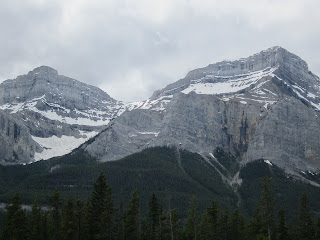
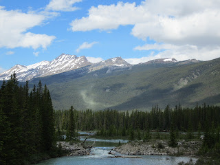
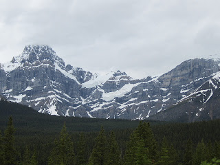
of thee most beautiful, majical, majestic, awe-inspiring drives we’ve ever
taken…these mountains put the ‘rocks in rocky’!
with the snowy mountains, jagged rocky peaks, grassy meadows, swampy
marshlands, glaciers, ice fields, rivers, glacial lakes, waterfalls and
wildlife—what a stunning journey. we
highly recommend it to all.
 |
| so alberta |
 |
| wondering what to do with all your old ball caps--just put them on your fence posts like these farmers do |
 |
| highwood river |
 |
| sheep on the road |
 |
| molting sheep |
 |
| we call them cattle guards (that's mt sir douglas in the distance) |
 |
| mt sir douglas |
the spine of the continental divide up to banff national park
 |
| kananaskis ski area south of banff national park on highway 40 |
 |
| reminds us of aspen, colorado--banff is not only a small tourist town but also a very popular national park |
 |
| downtown banff |
banff national park
 |
| trans canada highway heading north towards lake louise |
 |
| young male elk in velvet |
 |
| literally inches from our van |
 |
| clyclist on the 1a highway |
 |
| our 1st bear encounter--just feet off the road |
 |
| lake louise and victoria glacier |
 |
| chateau lake louise (one of the most photographed views in the
world) |
 |
| luckily we are heading north...look at that traffic heading south |
the following are more glorious photos of banff national park, up the icefield parkway viewing the columbia ice fields and jasper national park.
 |
| saskatchewan glacier--one of 7 glaciers in the columbia icefields |
 |
| one of the many multiple waterfalls along the drive |
 |
| heading into jasper town just before the rains begin |
after camping a rainy eve just outside jasper town in jasper nat’l park, we headed
north in our 1st real day of heavy rains since our trip began…a
couple hundred miles of rain and clouds, mostly uneventful and
unphotographed…we managed a rainy stop at a visitor center in grand cache, ab, where
they say the weather is forecast in the days to come, sun and warmer temps (mind you, the low on
the ride today was 41!)…but the real interesting thing about this stop is we
met a fellow texan from buddy’s hometown!
talk about a small world.
we’ve noticed how clean the roadsides are, not a lot of
garbage, shredded tires or tossed out fast food containers (which is so nice)
and the traffic the further north we go has diminished tenfold, yet still
plenty of semi trucks, pick up trucks, 5th wheels, bumper pulls and
small class b’s like ours. we assume the
majority of traffic we see are either locals, visitors or oil field workers
(yes, this is oil country--lots of natural gas). the
different road signs spark our interest and when the sign says no services for
135kms (~84 miles) they really mean it.
we stayed our last night in alberta, just south of the town
of grande prairie (the shopping capital of the north) before heading west into
british columbia and beginning the alaska highway at milepost 0 in dawson creek,
bc. the beautiful yellow fields of
canola intermittent with pine and birch forests sent us from alberta
with partly sunny skies and temps in the low 60s.
 |
| herd of elk leaving jasper |
 |
| alaska here we come |
 |
| canola fields |
 |
| northern alberta outside of grande prairie, the last city before crossing into bc and beginning the alcan highway |
see you on the alcan (alaska canadian) highway...


No comments:
Post a Comment