we meet a lot of travelers from all over the
world as we're sure you can imagine.
actually it’s probably gravy who meets the majority of them, and we
learn their dogs names as well…one day we met this young boy who was
walking his dog and we asked him where he was from…he told us, ‘north
pole’. now, how cool is that? it was like we were right out of the movie 'polar express'. neither of us have ever met anyone from the north pole before.
not only that, but we actually never knew where north pole was (remember we're talking the town of north pole, NOT THEE north pole!!)….well…we
do now! it’s ~15 miles southeast of fairbanks on the richardson (remember named highways up in these parts)
highway. and what a fun little
place. christmas in august...actually in north pole, alaska, it's christmas all year round. the light poles are red and white stripped like candy canes, so are the fire hydrants. the santa clause shop is full of ornaments and fudge, trees, even santa, and gift wrapping all year round. homes and businesses are encouraged to leave their outside decorations up all year long (even though it doesn't get dark enough to turn on the lights during the summer).
 |
| candy cane street lamps |
 |
| santa clause house |
after leaving north pole, we headed east down the richardson highway to intersect with the end of the alcan highway in delta junction about 98 miles from fairbanks. the drive was lovely, rolling hills, lots and lots of trees and with only 1 sighting of a fleeing moose. the many roadhouses found in these parts are strategically located along most of the highways, not only the alcan. rika's was one of the originals where a ferry crossing the tanana river once was. today there is a well constructed bridge.
 |
| the tanana river |
 |
| rika's roadhouse |
 |
| on the property |
 |
| flowers at rika's |
 |
| they have improved their toilet facilities since these days |
 |
| past transport |
 |
| the old barn |
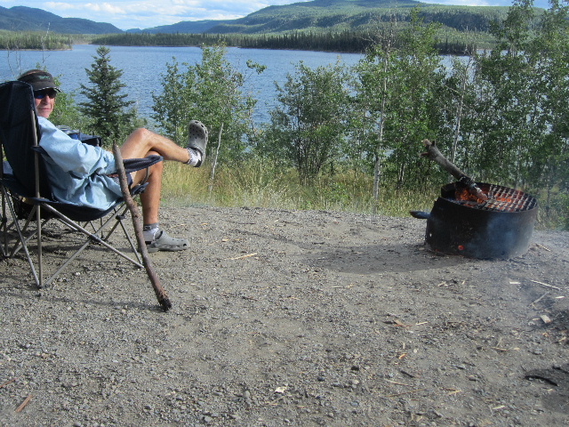
in delta junction, we made that inevitible stop at the end of the alcan highway, 1,422 miles from where we started back in dawson creek, bc, seemingly so long ago. we snapped a few shots and left in search of that nights camp. we camped in a wayside, next to the gerstle river and had the place to ourselves. buddy went in search of downed wood and we had a lovely fire while boondocking in an alaskan wayside--complete with fire ring, picnic table and pit toilets, plus all the free firewood you could find and chop. the next morning we picked wild raspberries to put in our cereal.
 |
| burrrrrr |
 |
| once thought of as the state bird!!! |
 |
| yup, we made it |
 |
| along the gerstle river |
 |
| our campsight |
moving ever southeast (fairbanks would be the furthest point north for us on this journey--wow, already?!?!) we continued down the alcan highway to the small town of tok, the 1st town in alaska, where we found ourselves back in early july. tok is for many their 1st and last alaskan town as it's at the junction for folks heading to/from fairbanks and denali or anchorge or the kenai peninsula (basically connecting you to anywhere in the state where there is a road); but for us, we turned north a few miles east of tok, on the taylor highway heading to our final alaskan town of chicken.
 |
| along the taylor highway |
while driving that day, we see some cyclists who we have seen and talked with before. would you believe they are the same two dutch cyclists we met a month ago near watson lake, on the alcan in the yukon. they had started in vancouver and were heading for fairbanks. they had already done almost 2,000 miles! what fun to see them after all this time.
 |
| klaske, rick and buddy |
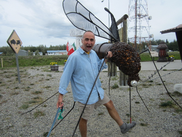
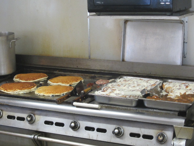
a funny little town chicken is, i guess it's the name. back during the gold rush in the 1880s, the first miners here wanted to name the town ptarmigan, after the alaskan state bird. but since they could not agree on the spelling and not wanting to be the laughing stock of the state, they settled on chicken, a bird that easily resembles the state bird. the town now makes up for this slight blunder by profiting from the hoards of toursits that come through buying everything 'chicken-y'!
 |
| what else are you gonna do with all those chicken eggs---and by the way, those pancakes are about the size of frisbee's--and those cinnamon rolls are some of the best we've ever had! |
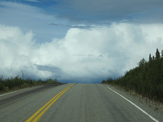
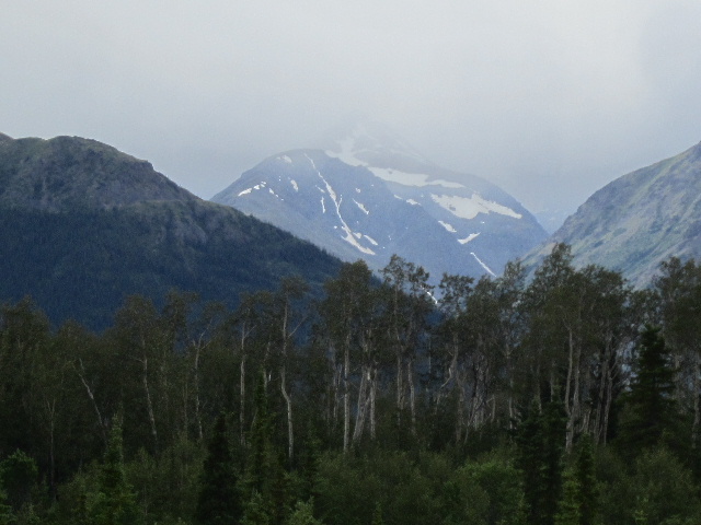
now if that isn't a good enough reason to head north before heading south, then maybe going over the 'top of the world highway' is a better reason. the highway is so named because, along much of it's length, it skirts the crest of the hills, giving looks down on the valleys. it is also one of the most northerly highways in the world at these longitudes.
just 3 days before our crossing of this sometimes narrow, all dirt, slippery-when-wet road (it had not been raining on the day we crossed, but it did the day before just enough to keep the dust down), a large 35' motorhome with tow vehicle went off the side. the tow vehicle saved the motorhome from rolling we heard, but never-the-less, it had gone over the side. the tow trucks were coming down the mountain with the wrecked vehicles when we were on our way up. how sad and scary for us to see...we had heard the driver had been flown to fairbanks to the hospital and the other 2 passengers where driven by blm (bureau of land management) personnel to fairbanks to join their loved one. we're not sure what the outcome was, but by the looks of the rv, it didn't look good.
 |
| this is where the accident happened |
 |
| yikes |
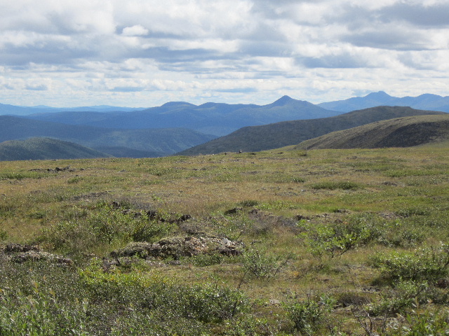
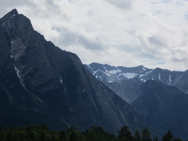
the sights were spectacular...altitudes were around 4,000 ft and the temps were in the 50s.
 |
| turnoff to eagle, ak (left) or continue right to dawson |
 |
| an old miners cabin near the top |
 |
| this is the US/Canadian border (taken from the canadian side) |
 |
| lunch and walk stop at the top |
this highway connects alaska to the gold rush town of dawson
city, thee town where it all began back in the 1890s. if you recall from an
earlier posting where we talked about the klondike gold rush, well this
is it. where the klondike and yukon rivers converge and where the 1st gold was discovered that inspired over 100,000 people to travel to this region in search of gold. to get to dawson
city from this direction today, you have to cross the yukon river by a very small ferry boat that
runs 24/7 and is free. the ride takes all but 10 minutes and only about
6-8 cars can load at a time, depending on their lengths.
 |
| the mighty yukon river |
 |
| dawson city from the west side of the river |
 |
| from west dawson, see the ferry in the background? |
we had a fun time in dawson, the real west of the west, taking the ferry and then walking the town, taking the canada parks led walking tour with insights to how life was like back in the 1890s and early 1900s.
 |
| watching a tourist steamer |
 |
| we're next onto the ferry |
 |
| our tour guide, colleen |
 |
| inside the old bar |
 |
| the old church built on perma frost |
 |
| the beautiful and mighty yukon |
we also had to see one of the nightly shows with showgirls at 'diamond tooth gerties'. ella, one of the dancers, thought buddy was 'so cute' that during the performance where they invite male members from the audience up to shake a leg with these scantily clad showgirls, buddy was her date! he was a true gentleman even when asked to take off her garter! you should have seen how red he got!!
 |
| buddy with gertie and the girls |
before leaving dawson after 2 days, we drove up dome road and had such a gorgeous view of the town, the convergence of the 2 rivers, and the sights far beyond.
 |
| dawson city with the yukon to the right and the klondike to the left (out of view) |
 |
| looking west down the yukon towards alaska |
 |
| looking east up the yukon |
 |
| the klondike in the foreground with gold tailings in the backround |
we took 2 days to make our way back to whitehorse (about 350 miles to the south) and if you remember, it's the most populated city in the yukon with ~26,000. another crossroads city along the alcan. we made camp 1/2 way down the klondike highway in twin lakes provincial park. the site was exquisite with views of one of the lakes--this has been buddy's favorite campsite.
on our way up the alcan, we thought just getting to whitehorse was, wow, such a feat, but now, working our way back to whitehorse, we see we are actually a long way from anywhere...it's still 1,095 miles from prince george, bc, or 1,582 from vancouver, 2,513 from denver, 3,200 miles from abilene and about 3,700 from nyc. guess we still have a long way to go!
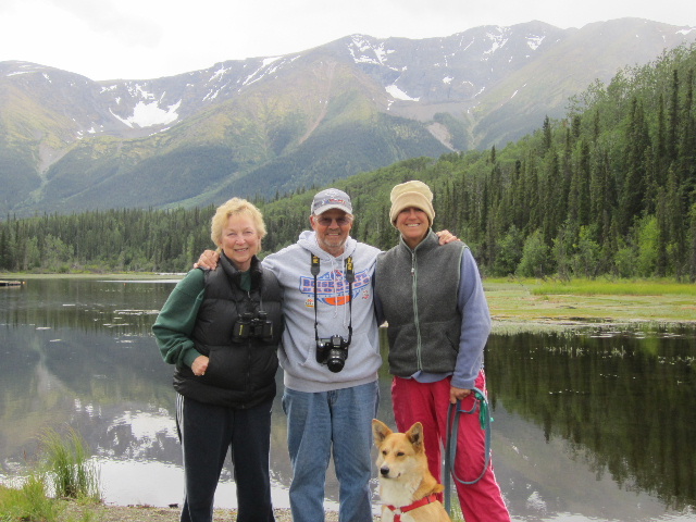
whitehorse is a good place to stock up on supplies, propane, gas, do laundry and eat a good meal out. we found this delicious restaurant on our way up and were looking forward to it on the way back down as well...their halibut is to die for! even better than many places in alaska. whitehorse is also a good place to meet up with old friends. on our way up the alcan and our very first day on the road, in dawson creek on the 4th of july, we met this very nice couple from washington, john and evie. we had been emailing each other during our month in alaska and discovered we'd be back in whitehorse at the same time. we planned on meeting at the klondike ribs and salmon restaurant and had a great evening sharing our alaska stories. we had so much fun that we decided to head down the road towards prince george somewhat together--planning evening stops but taking the day as we each wanted. we usually started our days early on the road and john and evie arrived later in the afternoon. we both wanted to turn south on the stewart cassiar highway instead of taking the alcan all the way back to dawson creek, so what fun to catch up each evening with some nice friends. the cassiar highway is a much newer road in bc, with less amenities but the scenery and road would be different.
after a night at a campground outside whitehorse, we headed back down the alcan towards watson lake, ~250 miles where we stopped for the night before heading south on the cassiar highway. we watched 2 black bears and a red tailed fox on that leg of the drive and enjoyed the days drive. we were also noticing that there is actually darkness to the nights...for most of june and july in alaska, you really don't notice the sky ever getting totally dark--so strange for us from the lower 48.
 |
| one of our last bear sightings in alaska |
 |
| our 1st red tailed fox on this trip |
we'd heard various tales of the stewart cassiar highway--it not being paved, that it wasn't a good road, that amenities where far and few, etc, but much to our delight they were only tales. the road was completely paved the entire 450 miles and true, amenities were far and few but with a bit of planning, it was very doable, plus the scenery was gorgeous. there was more road construction on this road than most we had driven, but overall it was a great choice.
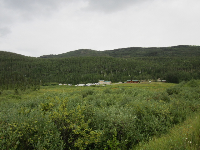
our normal day's drive of ~200 miles afforded us the opportunity to stay in a lovely campground shadowed by gorgeous mountains next to a small lake in the iskut valley in northern, bc. the hike to the lake was beautiful and the homemade chocolate chip cookie upon our arrival was a treat!
 |
| the northern part of the stewart-cassiar highway |
 |
| a bit of rain ahead |
 |
| beautiful wildflowers |
 |
| huge paintbrush |
 |
| some of our 1st power lines in photos since weeks back! |
 |
| our campground at mountain shadow |
 |
| the lake at mountain shadow |
 |
| evie, john, aly and gravy at the lake at mountain shadow |
 |
| road construction with a helicopter even |
from mountain shadow, our destination was another 200 miles south to the small towns of stewart, bc and hyder, alaska to see more bears fishing for spawning chum up fish creek.
the drive to stewart and hyder takes you past bear glacier, one so close to the road you could have touched it...almost.
hyder is not only the easternmost town in alaska, but it prides itself as being the friendliest ghost town in alaska with only ~90 residents. it's situated at the head of the portland canal, a 130-mile fjord, the 2nd longest on earth. the town itself isn't much, but the bear viewing is what brings tourists from july-september. a night in run-a-muck campground is about all you find in hyder plus a border crossing to get back into canada, but not one to get into hyder!
 |
| hyder--almost everything was closed... |
there is a small forest service run board walk with fees of
$5/person/day to view bears, both grizzly and black, eagles, and the occasional
wolf (which we did not have the chance to see, darn it) that frequent this very busy spawing river 5 miles from the sea.
 |
| going after an already dead salmon |
 |
| caught a live one! |
 |
| a juvenile bald eagle |
 |
| mama and her curious cub |
 |
| spawning salmon |
 |
| the viewing boardwalk |
 |
| a view from the boardwalk |
|
|
back on the cassier left us with 100 miles of southerly travel until we junctioned with the yellowhead highway which takes you from prince rupert to prince george. we saw a few more bear sightings along the road and our 1st dead bear as well. we had heard of numerous accidents while on this trip and often were witness to vehicle damage from trucks, rv's and motorcycles hitting bears, moose and caribou. thankfully, this was the only dead animal we saw on the road and it happened to be a small black bear. with most of the animal/vehicle accidents, the animal died and a few motorcyclists died as well, we heard.
we found our way back to seemingly what felt like civilization on saturday the 11th august on the yellowhead highway with much more traffic, more amenities, sunshine and the warmest day we have had since our 1 really nice day in anchorage. we camped in a gorgeous provincial park campground and had our 1st breakfast back in 'civilization' with john and evie. this would also be where we bid each other farewell and safe travels. they were headed to prince george then turning south towards washington state and we were heading to prince george and continuing east.
 |
| what a way to end a lovely 4 day drive with new friends and a delicious breakfast |
our journey to alaska has come to an end, but this is just the beginning of our next journey across canada! it's all a bit bittersweet, but when we think of what we have done, seen and experienced these past 3 months, we are really looking forward to the next 3! stay tuned...


I love all the bear pics, I wish we could have seen one when we went to Pagosa Springs. But, we did go to Treasure Falls and lots of other fun places. Looks like ya'll are having a blast. Be safe and continue on! Thanks for sharing your pics & story your so good. Love ya! Sheila
ReplyDelete